This week has been huge!
I finished the final edits for Blood of Heirs, finalised the map of Coraidin, and the cover for Blood of Heirs was revealed by the wonderful folks over at The Fantasy Hive!
Now the map is complete, I can share it with all of you and reveal some of the real life landmarks that inspired the South Lands.
First of all, I give you THE MAP!
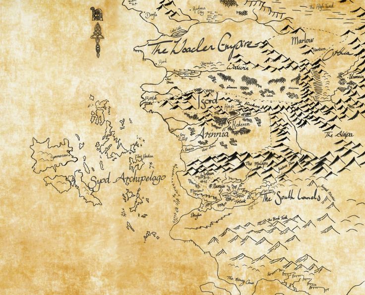
I began drafting this map while I was still in high school, many years before Blood of Heirs was even a twinkle in my eye. My first story was set in the Free Nations of Arinnia and Isord (though they had different names back then!), which explains why those countries are essentially in the centre of the ‘world’.
When I decided to shelve that ten year project, I was left with one character’s name and an empty space on the map. I knew the name “Lidan”, but I had no idea who she was or where she came from. I wanted to write something that used non-European style settings, and an Australian inspired region was just begging to be explored. Hence, the South Lands.
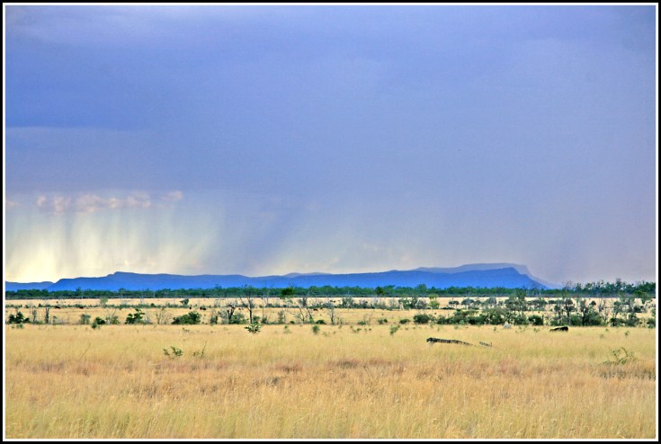
The main feature of Lidan’s home is the tablelands, drawn from the Blackdown Tablelands that loom over my hometown. They have an imposing presence in the otherwise flat, arid landscape, and can be seen for many kilometres around. When travelling the vast distances of our country, you always know you are home when the Tablelands rise up from the horizon, and I wanted to capture some of that emotion in the way Lidan feels about her home.
The following images were kindly provided by local photographers and do the Tablelands justice that my phone camera could not.


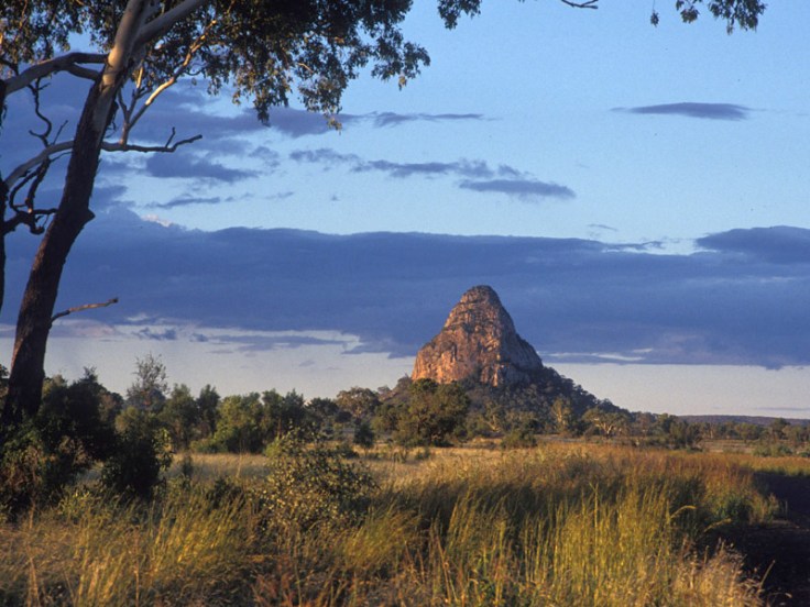
Other real world landmarks that feature in the South Lands include Wolfang Peak, which the Tolak people call the “Caine”, and the Gemini Peaks (Mt Castor and Mt Pollux), known by the Namjin people as “Jin’s Brothers”.

As for the rest of Coraidin, the inspirations are less specific and more atmospheric.
The northern regions, including Ranoth’s homeland of Orthia and the Woaden Empire, are a composite of the Australian Alpine region, New Zealand’s Southern Alps and parts of northern Europe. The Syod Archipelago was inspired by the Whitsunday Islands and the Great Barrier Reef, a few hours drive from where I live.
The great benefit of drawing on the landscape around you when world-building is that you are able to drag exactly what you see onto the page. You can use every sense to imagine how your characters would see their world, because it is laid out before you. You can explore it, and find tiny, unique characteristics that bring that world to life on the page.
I’m proud to showcase a little of my home in my books, and to have the opportunity to bring some of the stark, imposing beauty to the world beyond our outback home. I only hope I have done these amazing places justice in The Coraidic Sagas.
Yours in words,
AWB
